
The Big Rock at McGulpin Point
 About 390 years ago, pilgrims momentously set foot on the Eastern seaboard of the U.S. and Plymouth Rock was christened an enduring symbol of American settlement.
But 395 years ago, French explorers were plying the Straits of Mackinac and using a rock at least five times the size of Plymouth’s to gauge water levels as they navigated in canoes along the tumultuous waters between Michigan’s Upper and Lower Peninsulas.
The McGulpin Rock in Emmet County has been observed since at least 1615 as an aid to navigation for French explorers around the time voyager Etienne Brule was traveling the Great Lakes. Native Americans used it much earlier.
McGulpin Rock and the Straits of Mackinac history, while as significant and formative as the East Coast events, has remained largely out of textbooks because it was mainly the English who wrote early U.S. history, not the French, according to Sandy Planisek, a Mackinaw City resident, historian and author.
Planisek serves on the Emmet County Historical Commission and is involved heavily in researching the area’s history, particular the northwestern section of the county where the McGulpin Rock and McGulpin Point Lighthouse stand on the shores of Lake Michigan.
FACTS OF NOTE:
McGulpin Rock
Estimated discovery: 1615
Dimensions: 33.8 feet in horizontal circumference, 37 feet in vertical circumference
Height: 9 feet
Weight: 54 tons
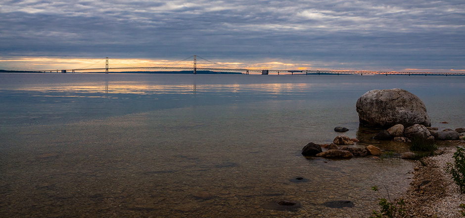
Location: Straits of Mackinac, Emmet County, Michigan
Plymouth Rock
Commemorative discovery: 1620
Dimensions: Circumference unknown.
Weight: Original — The top (visible) one-third of Plymouth Rock weighed about 4 tons; the bottom portion under the sand weighed about 6 tons, for a total of 10 tons. The rock as it exists today is estimated to be about one-third to one-half of its original size after being relocated, broken and chipped away at by 18th and 19th century souvenir hunters.
Location: Pilgrim Hall Museum, Plymouth, Mass.
“The French didn’t write the history books, but their contribution to our history is just as old, and that’s the point – it’s just as important. It’s all America,” said Planisek. “Our kids should feel proud that the Straits of Mackinac had a role in the founding of America, too – even though we’re not featured in their textbooks.”
(2010 information) With Thanksgiving approaching, historical commission members and Emmet County officials initiated a lighthearted competition with Plymouth, Mass., about the two rocks, in an effort to shine a light on important, historically significant landmarks in Emmet County, Michigan and across the United States. The idea originated with Dick Moehl several months ago. Moehl is the president of the Great Lakes Lighthouse Keepers Association in Mackinaw City and also a member of the county historical commission.
“The name of the game is to create interest and expound on the history we have here,” said Moehl. “This is an educational tool. We want people who visit Plymouth Rock to come to Emmet County and see the McGulpin Rock, and we want people who visit McGulpin Rock to go and visit Plymouth Rock.”
Moehl noted that the McGulpin Point Lighthouse property itself is one of the earliest deeded properties in the state of Michigan and among the first in Emmet County. The land marks important tribal grounds for the Odawa Indians, who remain a viable, active tribe today in Emmet County. In addition, the area was the stage for many early clashes between British, French and native forces at Fort Michilimackinac, also in Emmet County.
The McGulpin Rock was mentioned in 1749 in a journal by French-Canadian voyager Michel Chartier de Lotbiniere, who compiled sketches of the layout of Fort Michilimackinac and described the area in his writings.
His journal reads, in part, “They have observed that the waters of the Lakes have been lowering rather considerably over the past 10 years, and to prove this they showed me, at the entrance of Lake Michigan, one-half league from the fort, a large rock which now stands at least 7 feet out of water whereas ten years ago it was at water-level; they say it has become gradually more and more visible every year. The same thing was observed in Lake Superior. Older inhabitants told me that it (this phenomenon) was cyclic, that the waters go down during ten or twelve years and then rise again to approximately the same point.”
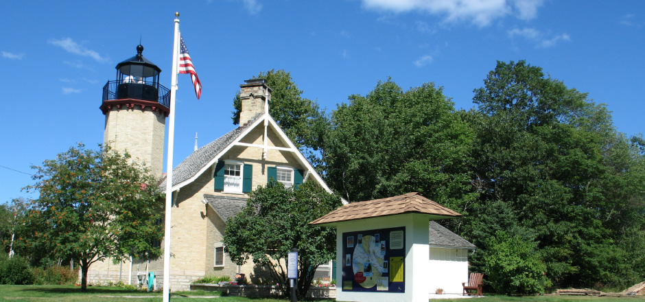
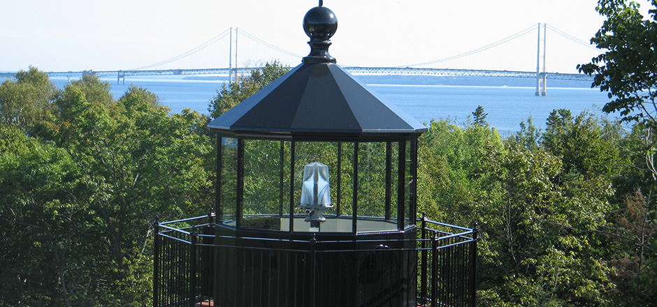
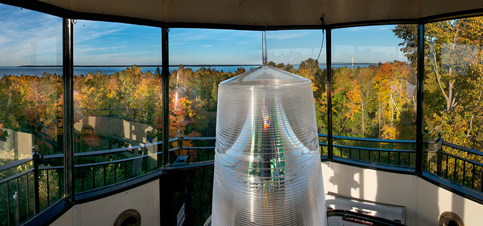
McGulpin Point Lighthouse and the 300 feet of Lake Michigan shoreline where McGulpin Rock rests are owned by Emmet County. The lighthouse operated from 1869-1906; it was purchased from private owners by the county in 2008. Since then, extensive restorations, including replacement of the light and its enclosed lantern room, have been completed.
It is open daily from May 15 until Oct. 31. In summer 2011, Emmet County will be celebrating the 250th anniversary of the arrival of Patrick McGulpin to the Straits of Mackinac. The county is planning celebrate his arrival with several special events.
“Emmet County continues to look ahead and provide recreational opportunities for visitors and residents, while working diligently to preserve and protect our rich history,” said Laurie Gaetano, the county’s parks and recreation director. “The McGulpin Rock and the lighthouse are two important pieces of our history and it’s our job to share that with others so they will remain protected for generations to come.”
(The Big Rock Challenge with Plymouth took place in 2010)
